 Go to BKOOL
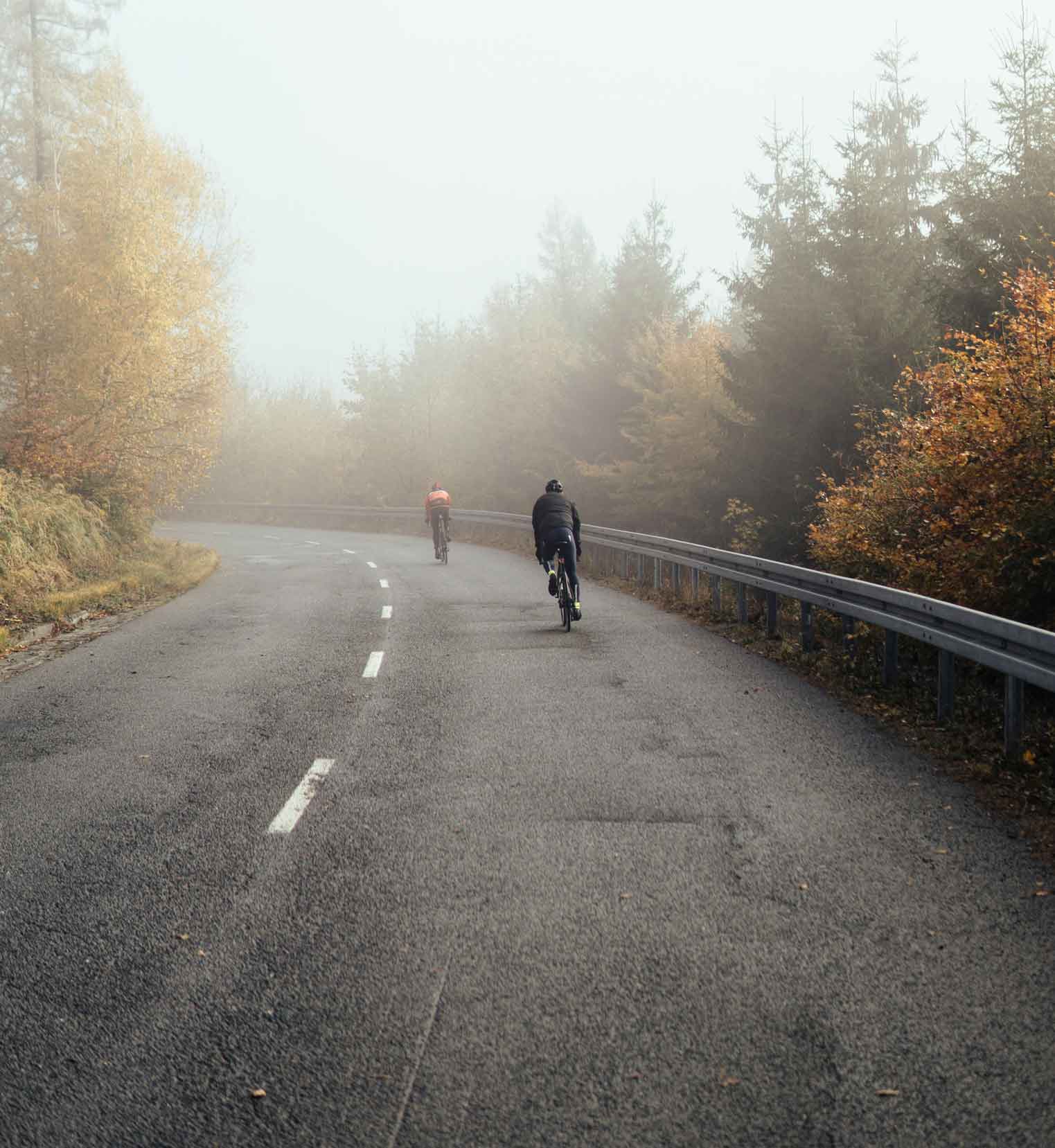
Cycling is a great way to exercise, train and disconnect. If you add to these advantages that during the training session you can enjoy the scenery of one of the most beautiful countries in South America, you will want to grab your bike right now. If you have never travelled to South America before but would like to get to know one of its most beautiful countries, here are the best cycling routes in Colombia.
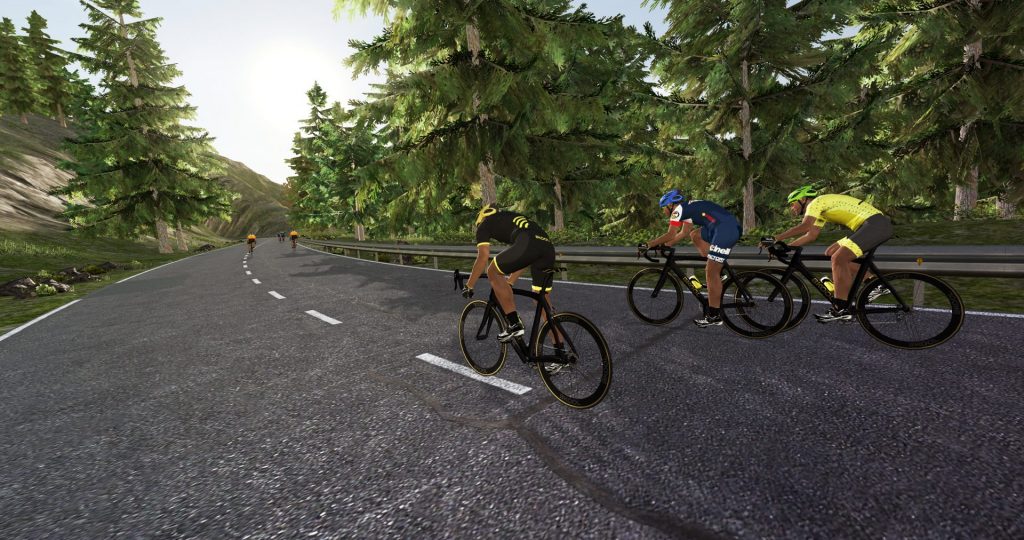
And best of all, you can ride these routes without leaving home thanks to BKOOL, the cycling simulator that allows you to train in realistic settings from around the world. Get ready to pedal through Colombia’s most spectacular landscapes and feel the thrill of every climb, descent, and turn with a fully immersive experience. Adjust your trainer, connect to the app, and start the adventure!
Best cycling routes in Colombia
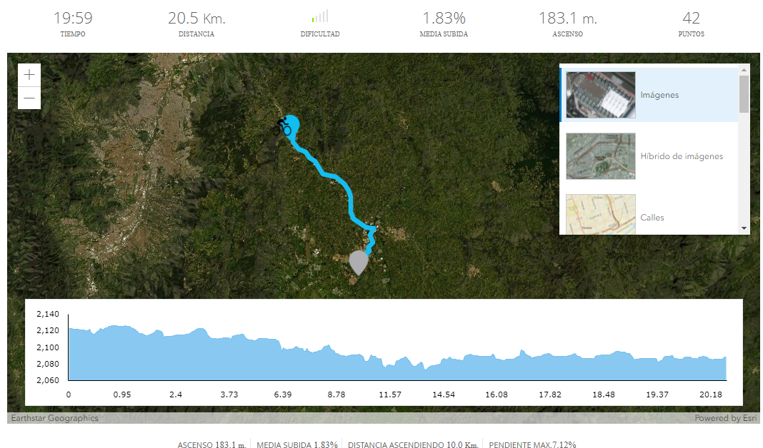
1. Guarne – Rionegro
Not far from Medellín is this fantastic 20.5 kilometre route that can be done in 20 minutes. Its ascent is 183 metres, with a maximum gradient of 7.12%. This is an doable road route for beginners, in which you travel along the Medellin Bogota highway. This section links the towns of Guarne and Rionegro, where you can observe the typical Colombian architecture.
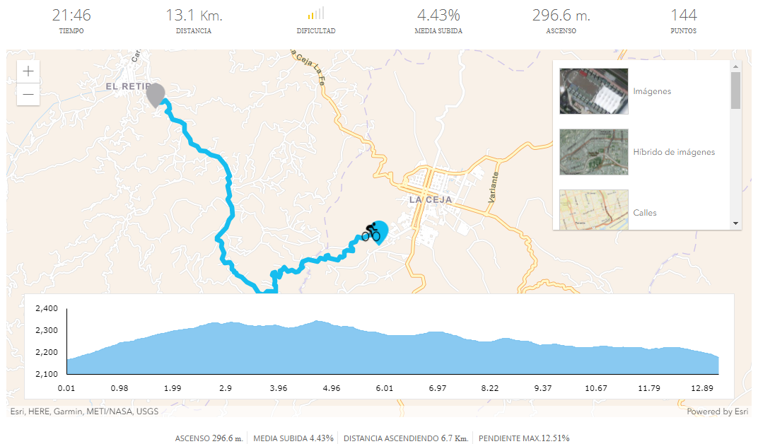
2. La Ceja – El Retiro via Pantanillo
This route is shorter than the previous one, 13.1 kilometres, however, it has a higher level of difficulty. The estimated time for this session is 21 minutes 46 seconds. Its degree of difficulty 2/5 is due to the ascent of 296.6 metres, having an average ascente of 4.43%. The maximum slope is 12.51%, whose ascent distance is 6.7 kilometres.
Along the route you will be able to enjoy the views of the forests and meadows that surround the road. Starting in La Ceja and ending in El Retiro, you will enter the green landscape that characterises Colombia.
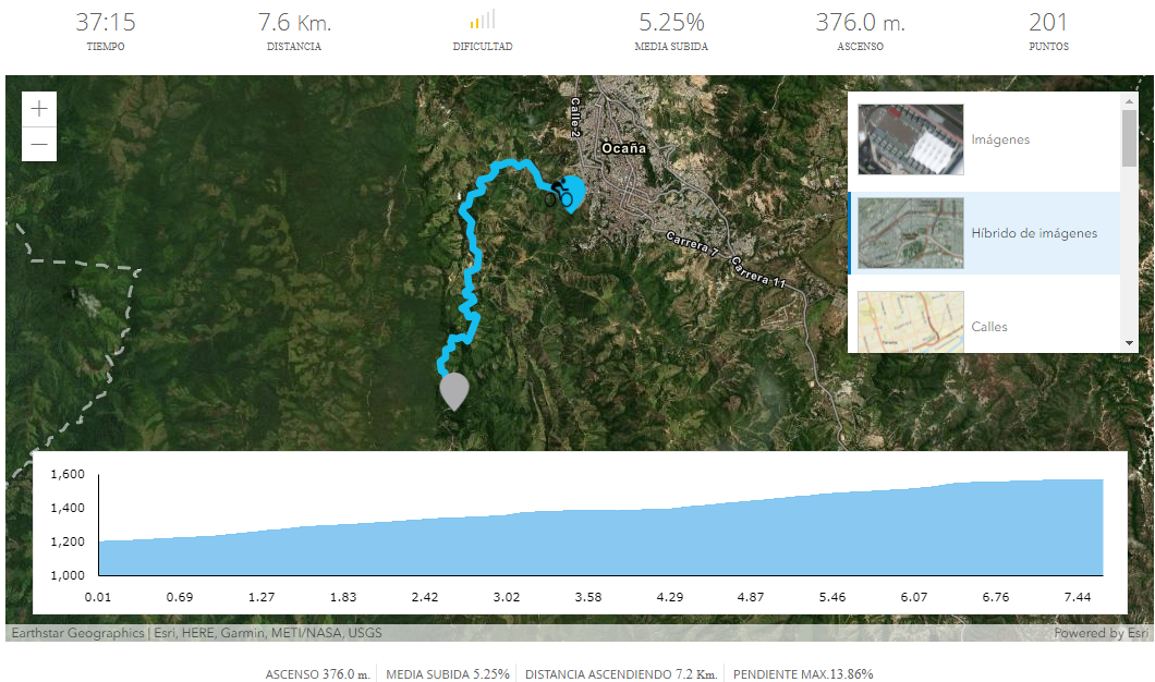
3. Ocaña / Norte de Santander
With a distance of 7.6 kilometres, this route has an estimated time of 37 minutes and 15 seconds. This distance-time ratio is due to the 376 metres of ascent that the section between Ocaña and Norte de Santander has. This road session has an average ascent of 5.25%, with a maximum gradient of 13.86% and an ascent distance of 7.2 kilometres, practically the entire route.
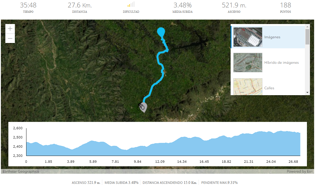
4. San Pedro de los Milagros
San Pedro de los Milagros is known as “La Puerta Cultural del Norte” or “La Sixtina de Antioquia” thanks to its historical and artistic heritage. On this route we cross the famous municipality of the Antioquia region.
This is the longest route, with 27.6 kilometres that are covered in 35 minutes and 48 seconds. Its ascent is 521.9 metres. The maximum slope is 9.31% and more than half of the route is uphill: 15 kilometres. By road, you will be able to enjoy the Colombian countryside and its infinite meadows.
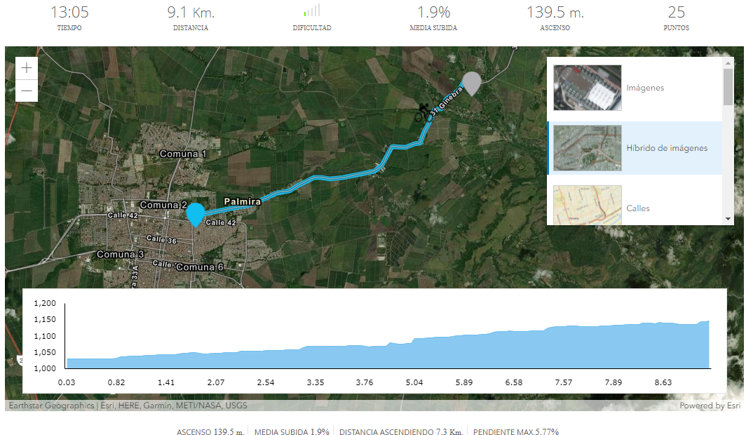
5. Palmira Tiendanueva
Palmira, known as La Villa de las Palmas, is 26 kilometres from Cali, the capital of the country. We did not forget those who prefer to enjoy without suffering, so this route of 9.1 kilometres, whose estimated time is 13 minutes, is perfect for them. It has 139.5 metres of ascent, with an average climb of 1.9%. The maximum slope is 5.77%, so its difficulty is 1/5. Enjoy the inland part of this country.
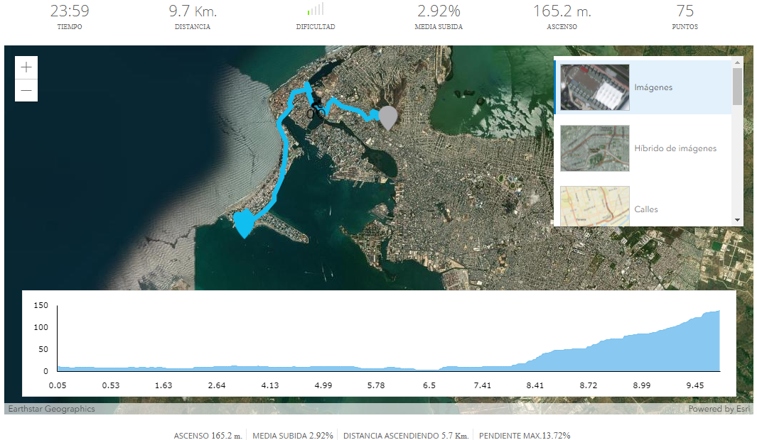
6. Cartagena, Cerro de la Popa (Popa Hill)
We leave the interior of the country to approach its coast for the first time. We do so in the famous Cartagena, on the shores of the Caribbean Sea.
During 9.7 kilometres of distance and 24 minutes of riding, you will be able to move along the coast of Colombia and see the sea that bathes it. The ascent is 165.2 metres and the average climb is 2.92%. This stretch between Cartagena and the Cerro de la Popa is perfect for enjoying the sea views.
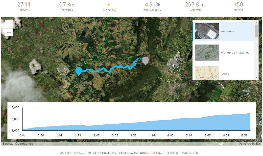
7.Subachoque / Cundinamarca
This rout takes place between Subachoque and Cundinamarca, so you will ride on the road while observing the prairies of Colombia.
It is only 6.7 kilometres long, however, it has 297.8 metres of ascent. Its difficulty is 2/5, so it is understood that the estimated time is 27 minutes and 11 seconds. The maximum slope is 12.13% and the ascent distance is 6.1 kilometres, practically the entire route.
La Union
This route takes us from the outskirts of the municipality of La Ceja, also in Antioquia, to La Unión – some 2.5 kilometres past the town – which it borders to the east. The route is 15.8 kilometres long, with an average gradient of 4.4% and a total ascent of 481.5 metres.
The route, which can be completed in about 25 minutes, is slightly more difficult than Guarne-Rionegro, mainly due to its gradient, almost all of which is accumulated during the first half.
These are 8 cycling routes that will surprise you in Colombia, however, they are not the only ones. Cycling is linked to the enjoyment of nature, so we work to bring these landscapes to indoor cycling.
BKOOL is the most complete cycling simulator on the market, try it FREE for 7 days!